Best Selling
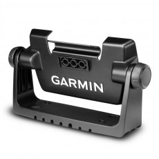
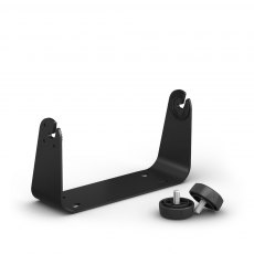
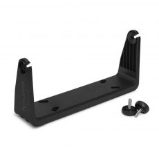
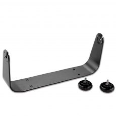
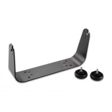
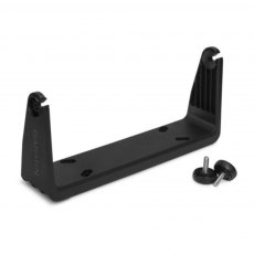
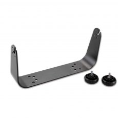
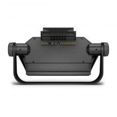
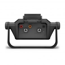
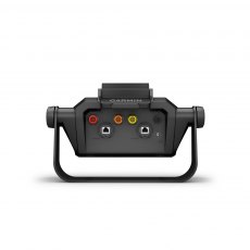
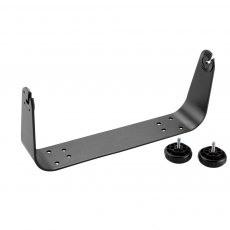
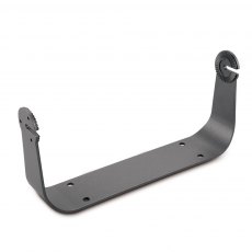
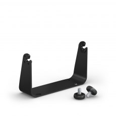
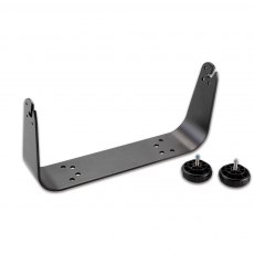
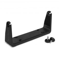
Garmin Bail Mount for EchoMAP 72/75/92/95
Surface mount your ECHOMAP™ using our bail mount with knobs; the mount tilts for optimum viewing. With the mount’s quick cable disconnect feature, you can plug the necessary cords into the mount, allowing you to seat/unseat your device with ease.
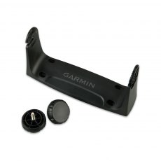
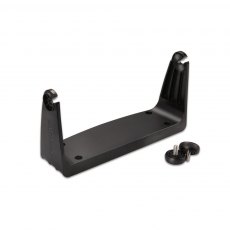
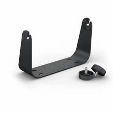
Garmin Bail Mount for GPSMAP 720/740
Surface mount your compatible GPSMAP® device with this bail mount with knobs. .
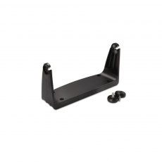
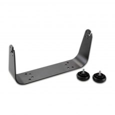
Garmin Bail Mount for GPSMAP 7407/7607
Surface mount your GPSMAP using our bail mount with knobs. The mount tilts for optimum viewing.
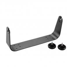
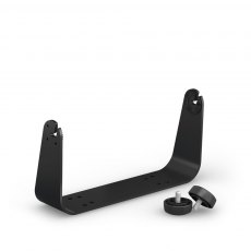
Garmin Bail Mount for GPSMAP 7416/7616
Surface mount your GPSMAP using our bail mount with knobs. The mount swivels and tilts for optimum viewing.
Garmin Bail Mount for GPSMAP 923
Surface mount your compatible GPSMAP device using our bail mount with knobs. The mount tilts for optimum viewing.
Garmin Bail Mount for STRIKER 9
Secure your compatible marine device with this mount, featuring tilt capabilities for optimum viewing.
Garmin Bail Mount with Knobs (GPSMAP 1000 Series)
Surface mount your GPSMAP using this bail mount with knobs. The mount swivels and tilts for optimum viewing.
Garmin Bail Mount with Knobs (GPSMAP 12x2 Series)
Surface mount your compatible GPSMAP using our bail mount with knobs. The mount tilts for optimum viewing.
Garmin Bail Mount with Knobs (GPSMAP9x2 Series)
Surface mount your compatible GPSMAP using our bail mount with knobs. The mount tilts for optimum viewing.
Garmin Bail Mount with Knobs GPSMAP 7410 / 7610
Surface mount your GPSMAP using this bail mount with knobs. The mount tilts for optimum viewing.
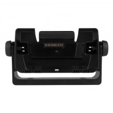
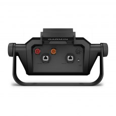
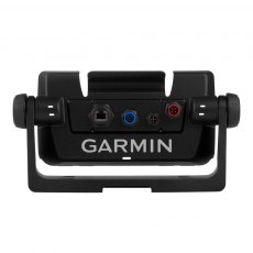
Garmin Bail Mount with Quick Release Cradle - EchoMAP CHIRP 75sv/92/95
Surface mount your compatible ECHOMAP™ chartplotter/sounder combo using our bail mount with knobs; the mount tilts for optimum viewing. With the mount’s quick cable disconnect feature, you can plug the necessary cords into the mount, allowing you to seat/unseat your device with ease.
Garmin Bail Mount With Quick Release Cradle For Echomap Ultra2 102sv
Surface mount a compatible ECHOMAP Ultra 2 chartplotter by using this bail mount with knobs; the mount tilts for optimum viewing. Plugging the cables into the mount’s quick-release cradle allows users to quickly seat/unseat the device with ease.
Garmin Bail Mount With Quick Release Cradle For Echomap Ultra2 122sv
Surface mount a compatible ECHOMAP Ultra 2 chartplotter by using this bail mount with knobs; the mount tilts for optimum viewing. Plugging the cables into the mount’s quick-release cradle allows users to quickly seat/unseat the device with ease.
Garmin Bail Trunnion Mount & Quick Release Cradle for ECHOMAP Ultra 102
Surface mount your compatible ECHOMAP™ Ultra chartplotter/sounder combo using our bail mount with knobs; the mount tilts for optimum viewing.
Garmin Bail Trunnion Mount & Quick Release Cradle for ECHOMAP Ultra 122
Surface mount your compatible ECHOMAP™ Ultra chartplotter/sounder combo using our bail mount with knobs; the mount tilts for optimum viewing. Plugging the cables into the mount’s quick-release cradle allows you to seat/unseat your device with ease.
Garmin Bail Trunnion Mount for EchoMAP 70/GPSMAP 721-751
Surface mount your ECHOMAP or GPSMAP® using our bail mount with knobs. The mount swivels and tilts for optimum viewing.
Garmin Bail Trunnion Mount For GPSMAP 10x2 Series
Surface mount any compatible GPSMAP using our bail mount with knobs. The mount tilts for optimum viewing.
Garmin Bail Trunnion Mount for GPSMAP 1223
Surface mount your compatible GPSMAP device using our bail mount with knobs. The mount tilts for optimum viewing.
Garmin Bail Trunnion Mount for GPSMAP 12x2 Touch / 7x2 Series
Surface mount a Compatible GPSMAP using this bail mount with knobs. The mount tilts for optimum viewing.
Garmin Bail Trunnion Mount for GPSMAP 4008
Replacement Bail Mount for GPSMAP 4008 Weight: 249 gSize: 31 x 13.5 x 2.5 cm
Garmin Bail Trunnion Mount for GPSMAP 723
Surface mount your compatible GPSMAP device using our bail mount with knobs. The mount tilts for optimum viewing.
Garmin Bail Trunnion Mount for GPSMAP 7408/7608
Surface mount your GPSMAP using our bail mount with knobs. The mount swivels and tilts for optimum viewing.
Garmin Bail Trunnion Mount inc Knobs (GPSMAP 7x2 Series)
Surface mount your compatible GPSMAP using our bail mount with knobs. The mount tilts for optimum viewing.
Garmin Bail Trunnion Mount with Knobs for GPSMAP16xx
Bail mount with knobs for Garmin GPSMAP 16XX series chartplotters. Allows the mounted device to be tilted for optimum viewing.
Garmin Bail Trunnion Mount with Quick Release Cradle for EchoMAP CHIRP 75dv
Surface mount your compatible ECHOMAP™ chartplotter/sounder combo using our bail mount with knobs; the mount tilts for optimum viewing. With the mount’s quick cable disconnect feature, you can plug the necessary cords into the mount, allowing you to seat/unseat your device with ease.
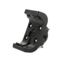
Garmin Bar Mount for GPSMAP 276Cx
Take your Montana anywhere and everywhere with this handlebar mount. Simply snap your device - in any orientation, portrait or landscape - into the 22 to 32 mm rugged mount, which attaches to any standard bicycle handlebar, and it's ready for your next cycling tour or mountain biking adventure. A molded rubber cushion is included in the kit to increase the mount's grip on the handlebar and also to prevent rotation during possible vibration. Kit also includes hardware and instructions.
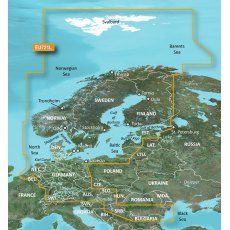
Garmin Blue Chart G3 Vision Large Area - VEU721L Northern Europe
Experience unparalleled coverage and brilliant detail when you're on the water. BlueChart G3 Vision coastal charts provide industry-leading coverage, clarity and detail with integrated Garmin and Navionics content. Compatible with the Garmin GPSMAP and ECHOMAP series Chartplotters.
Garmin BlueChart g2 Vision Update Card
Addition of European region: EU717L- East Mediterranean and Black Sea Nautical navigation with high-precision charting Premium mapping features including high-resolution satellite imagery', 3D perspectives above and below the waterline AutoGuidance technology finds the course for navigation Mariner’s eye view provides 3D perspective of chart information above the waterline for a quick, reliable...
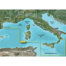
Garmin BlueChart G3 - HXEU012R: Mediterranean, Central-West
BlueChart g3 coastal charts provide industry-leading coverage, clarity and detail with integrated Garmin and Navionics data. Also included is Auto Guidance technology, which uses your desired depth and overhead clearance to calculate routes and provide a suggested path to follow — overlaid onto your chart. NOAA raster cartography is also available as a free downloadable feature via the ActiveCaptain app. It gives your chartplotter paper chartlike views of NOAA-surveyed areas in which individual points of interest are labelled with corresponding longitude and latitude information. Worldwide coverage is available by regions as accessory cards or via download; each region is sold separately. Compatable with ECHOMAP™ Plus series chartplotters.
Garmin Bluechart G3 EU003R Great Britain, Northeast Coast
EU003R Garmin Bluechart G3 Great Britain, Northeast Coast
Unparalleled Coastal Chart Coverage
Provides industry-leading coverage, clarity and detail with updated coastal charts that feature integrated Garmin and Navionics data
Auto Guidance1 technology calculates a route using your desired depth and overhead clearance and provides a suggested path to follow
Includes Depth Range Shading...
Garmin Bluechart G3 EU005R Ireland, West Coast
EU005R Garmin Bluechart G3 Ireland, West Coast
Unparalleled Coastal Chart Coverage
Provides industry-leading coverage, clarity and detail with updated coastal charts that feature integrated Garmin and Navionics data
Auto Guidance1 technology calculates a route using your desired depth and overhead clearance and provides a suggested path to follow
Includes Depth Range Shading for up to...
Garmin Bluechart G3 EU018R Benelux Offshore & Inland Waters
EU018R Garmin Bluechart G3 Benelux Offshore & Inland Waters
Unparalleled Coastal Chart Coverage
Provides industry-leading coverage, clarity and detail with updated coastal charts that feature integrated Garmin and Navionics data
Auto Guidance1 technology calculates a route using your desired depth and overhead clearance and provides a suggested path to follow
Includes Depth Range Shading...
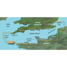
Garmin BlueChart G3 Regular Area - HXEU001R English Channel
BlueChart g3 coastal charts provide industry-leading coverage, clarity and detail with integrated Garmin and Navionics data. Also included is Auto Guidance technology, which uses your desired depth and overhead clearance to calculate routes and provide a suggested path to follow — overlaid onto your chart. NOAA raster cartography is also available as a free downloadable feature via the ActiveCaptain app. It gives your chartplotter paper chartlike views of NOAA-surveyed areas in which individual points of interest are labelled with corresponding longitude and latitude information. Worldwide coverage is available by regions as accessory cards or via download; each region is sold separately. Compatable with ECHOMAP™ Plus series chartplotters.
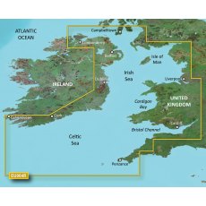
Garmin BlueChart G3 Regular Area - HXEU004R Irish Sea
BlueChart g3 coastal charts provide industry-leading coverage, clarity and detail with integrated Garmin and Navionics data. Also included is Auto Guidance technology, which uses your desired depth and overhead clearance to calculate routes and provide a suggested path to follow — overlaid onto your chart. NOAA raster cartography is also available as a free downloadable feature via the ActiveCaptain app. It gives your chartplotter paper chartlike views of NOAA-surveyed areas in which individual points of interest are labelled with corresponding longitude and latitude information. Worldwide coverage is available by regions as accessory cards or via download; each region is sold separately. Compatable with ECHOMAP™ Plus series chartplotters.
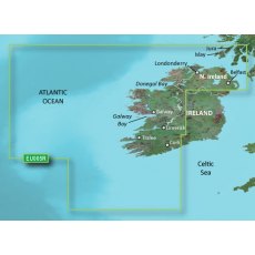
Garmin BlueChart G3 Regular Area - HXEU005R Ireland, West Coast
BlueChart g3 coastal charts provide industry-leading coverage, clarity and detail with integrated Garmin and Navionics data. Also included is Auto Guidance technology, which uses your desired depth and overhead clearance to calculate routes and provide a suggested path to follow — overlaid onto your chart. NOAA raster cartography is also available as a free downloadable feature via the ActiveCaptain app. It gives your chartplotter paper chartlike views of NOAA-surveyed areas in which individual points of interest are labelled with corresponding longitude and latitude information. Worldwide coverage is available by regions as accessory cards or via download; each region is sold separately. Compatable with ECHOMAP™ Plus series chartplotters.
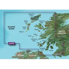
Garmin BlueChart G3 Regular Area - HXEU006R Scotland, West Coast
BlueChart g3 coastal charts provide industry-leading coverage, clarity and detail with integrated Garmin and Navionics data. Also included is Auto Guidance technology, which uses your desired depth and overhead clearance to calculate routes and provide a suggested path to follow — overlaid onto your chart. NOAA raster cartography is also available as a free downloadable feature via the ActiveCaptain app. It gives your chartplotter paper chartlike views of NOAA-surveyed areas in which individual points of interest are labelled with corresponding longitude and latitude information. Worldwide coverage is available by regions as accessory cards or via download; each region is sold separately. Compatable with ECHOMAP™ Plus series chartplotters.
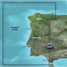
Garmin BlueChart G3 Regular Area - HXEU009R Portugal & Northwest Spain
BlueChart g3 coastal charts provide industry-leading coverage, clarity and detail with integrated Garmin and Navionics data. Also included is Auto Guidance technology, which uses your desired depth and overhead clearance to calculate routes and provide a suggested path to follow — overlaid onto your chart. NOAA raster cartography is also available as a free downloadable feature via the ActiveCaptain app. It gives your chartplotter paper chartlike views of NOAA-surveyed areas in which individual points of interest are labelled with corresponding longitude and latitude information. Worldwide coverage is available by regions as accessory cards or via download; each region is sold separately. Compatable with ECHOMAP™ Plus series chartplotters.
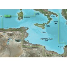
Garmin BlueChart G3 Regular Area - HXEU013R Italy Southwest & Tunisia
BlueChart g3 coastal charts provide industry-leading coverage, clarity and detail with integrated Garmin and Navionics data. Also included is Auto Guidance technology, which uses your desired depth and overhead clearance to calculate routes and provide a suggested path to follow — overlaid onto your chart. NOAA raster cartography is also available as a free downloadable feature via the ActiveCaptain app. It gives your chartplotter paper chartlike views of NOAA-surveyed areas in which individual points of interest are labelled with corresponding longitude and latitude information. Worldwide coverage is available by regions as accessory cards or via download; each region is sold separately. Compatable with ECHOMAP™ Plus series chartplotters.
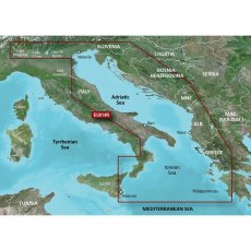
Garmin BlueChart G3 Regular Area - HXEU014R Italy, Adriatic Sea
BlueChart g3 coastal charts provide industry-leading coverage, clarity and detail with integrated Garmin and Navionics data. Also included is Auto Guidance technology, which uses your desired depth and overhead clearance to calculate routes and provide a suggested path to follow — overlaid onto your chart. NOAA raster cartography is also available as a free downloadable feature via the ActiveCaptain app. It gives your chartplotter paper chartlike views of NOAA-surveyed areas in which individual points of interest are labelled with corresponding longitude and latitude information. Worldwide coverage is available by regions as accessory cards or via download; each region is sold separately. Compatable with ECHOMAP™ Plus series chartplotters.
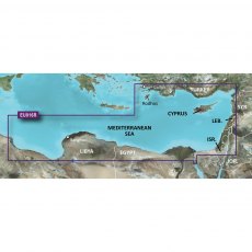
Garmin BlueChart G3 Regular Area - HXEU016R Mediterranean Southeast
BlueChart g3 coastal charts provide industry-leading coverage, clarity and detail with integrated Garmin and Navionics data. Also included is Auto Guidance technology, which uses your desired depth and overhead clearance to calculate routes and provide a suggested path to follow — overlaid onto your chart. NOAA raster cartography is also available as a free downloadable feature via the ActiveCaptain app. It gives your chartplotter paper chartlike views of NOAA-surveyed areas in which individual points of interest are labelled with corresponding longitude and latitude information. Worldwide coverage is available by regions as accessory cards or via download; each region is sold separately. Compatable with ECHOMAP™ Plus series chartplotters.
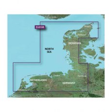
Garmin BlueChart G3 Regular Area - HXEU019R Alborg-Amsterdam
BlueChart g3 coastal charts provide industry-leading coverage, clarity and detail with integrated Garmin and Navionics data. Also included is Auto Guidance technology, which uses your desired depth and overhead clearance to calculate routes and provide a suggested path to follow — overlaid onto your chart. NOAA raster cartography is also available as a free downloadable feature via the ActiveCaptain app. It gives your chartplotter paper chartlike views of NOAA-surveyed areas in which individual points of interest are labelled with corresponding longitude and latitude information. Worldwide coverage is available by regions as accessory cards or via download; each region is sold separately. Compatable with ECHOMAP™ Plus series chartplotters.
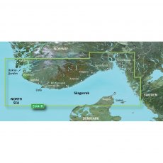
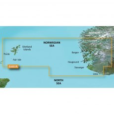
Garmin BlueChart G3 Regular Area - HXEU041R Oslo-Skagerak-Haugesund
BlueChart g3 coastal charts provide industry-leading coverage, clarity and detail with integrated Garmin and Navionics data. Also included is Auto Guidance technology, which uses your desired depth and overhead clearance to calculate routes and provide a suggested path to follow — overlaid onto your chart. NOAA raster cartography is also available as a free downloadable feature via the ActiveCaptain app. It gives your chartplotter paper chartlike views of NOAA-surveyed areas in which individual points of interest are labelled with corresponding longitude and latitude information. Worldwide coverage is available by regions as accessory cards or via download; each region is sold separately. Compatable with ECHOMAP™ Plus series chartplotters.
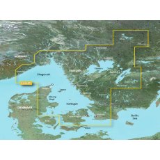
Garmin BlueChart G3 Regular Area - HXEU042R Oslo-Trelleborg
BlueChart g3 coastal charts provide industry-leading coverage, clarity and detail with integrated Garmin and Navionics data. Also included is Auto Guidance technology, which uses your desired depth and overhead clearance to calculate routes and provide a suggested path to follow — overlaid onto your chart. NOAA raster cartography is also available as a free downloadable feature via the ActiveCaptain app. It gives your chartplotter paper chartlike views of NOAA-surveyed areas in which individual points of interest are labelled with corresponding longitude and latitude information. Worldwide coverage is available by regions as accessory cards or via download; each region is sold separately. Compatable with ECHOMAP™ Plus series chartplotters.
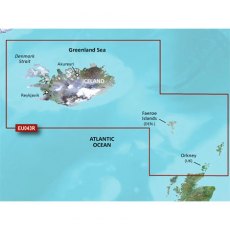
Garmin BlueChart G3 Regular Area - HXEU043R Iceland to Orkney
BlueChart g3 coastal charts provide industry-leading coverage, clarity and detail with integrated Garmin and Navionics data. Also included is Auto Guidance technology, which uses your desired depth and overhead clearance to calculate routes and provide a suggested path to follow — overlaid onto your chart. NOAA raster cartography is also available as a free downloadable feature via the ActiveCaptain app. It gives your chartplotter paper chartlike views of NOAA-surveyed areas in which individual points of interest are labelled with corresponding longitude and latitude information. Worldwide coverage is available by regions as accessory cards or via download; each region is sold separately. Compatable with ECHOMAP™ Plus series chartplotters.
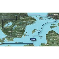
Garmin BlueChart G3 Regular Area - HXEU046R Sweden, South-East
BlueChart g3 coastal charts provide industry-leading coverage, clarity and detail with integrated Garmin and Navionics data. Also included is Auto Guidance technology, which uses your desired depth and overhead clearance to calculate routes and provide a suggested path to follow — overlaid onto your chart. NOAA raster cartography is also available as a free downloadable feature via the ActiveCaptain app. It gives your chartplotter paper chartlike views of NOAA-surveyed areas in which individual points of interest are labelled with corresponding longitude and latitude information. Worldwide coverage is available by regions as accessory cards or via download; each region is sold separately. Compatable with ECHOMAP™ Plus series chartplotters.
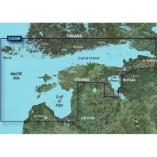
Garmin BlueChart G3 Regular Area - HXEU050R Gulfs of Finland & Riga
BlueChart g3 coastal charts provide industry-leading coverage, clarity and detail with integrated Garmin and Navionics data. Also included is Auto Guidance technology, which uses your desired depth and overhead clearance to calculate routes and provide a suggested path to follow — overlaid onto your chart. NOAA raster cartography is also available as a free downloadable feature via the ActiveCaptain app. It gives your chartplotter paper chartlike views of NOAA-surveyed areas in which individual points of interest are labelled with corresponding longitude and latitude information. Worldwide coverage is available by regions as accessory cards or via download; each region is sold separately. Compatable with ECHOMAP™ Plus series chartplotters.
Garmin BlueChart G3 Regular Area - HXEU051R Lista-Sognefjorden
BlueChart g3 coastal charts provide industry-leading coverage, clarity and detail with integrated Garmin and Navionics data. Also included is Auto Guidance technology, which uses your desired depth and overhead clearance to calculate routes and provide a suggested path to follow — overlaid onto your chart. NOAA raster cartography is also available as a free downloadable feature via the ActiveCaptain app. It gives your chartplotter paper chartlike views of NOAA-surveyed areas in which individual points of interest are labelled with corresponding longitude and latitude information. Worldwide coverage is available by regions as accessory cards or via download; each region is sold separately. Compatable with ECHOMAP™ Plus series chartplotters.
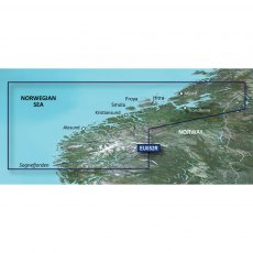
Garmin BlueChart G3 Regular Area - HXEU052R Sognefjorden-Svefjorden
BlueChart g3 coastal charts provide industry-leading coverage, clarity and detail with integrated Garmin and Navionics data. Also included is Auto Guidance technology, which uses your desired depth and overhead clearance to calculate routes and provide a suggested path to follow — overlaid onto your chart. NOAA raster cartography is also available as a free downloadable feature via the ActiveCaptain app. It gives your chartplotter paper chartlike views of NOAA-surveyed areas in which individual points of interest are labelled with corresponding longitude and latitude information. Worldwide coverage is available by regions as accessory cards or via download; each region is sold separately. Compatable with ECHOMAP™ Plus series chartplotters.


