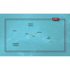
Garmin BlueChart G3 Vision Small Area - VEU502S - Azores Islands
Experience unparalleled coverage and brilliant detail when you're on the water. BlueChart G3 Vision coastal charts provide industry-leading coverage, clarity and detail with integrated Garmin and Navionics content. Compatable with the Garmin GPSMAP and ECHOMAP series Chartplotters.
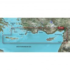
Garmin BlueChart G3 Vision Small Area - VEU506S - Crete - Cyprus
Experience unparalleled coverage and brilliant detail when you're on the water. BlueChart G3 Vision coastal charts provide industry-leading coverage, clarity and detail with integrated Garmin and Navionics content. Compatable with the Garmin GPSMAP and ECHOMAP series Chartplotters.
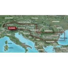
Garmin BlueChart G3 Vision Small Area - VEU509S - Danube River
Experience unparalleled coverage and brilliant detail when you're on the water. BlueChart G3 Vision coastal charts provide industry-leading coverage, clarity and detail with integrated Garmin and Navionics content. Compatable with the Garmin GPSMAP and ECHOMAP series Chartplotters.
Garmin Bluechart G3 Vision VEU456S English Channel, Central-East
VEU456S Garmin BlueChart G3 Vision -English Channel, Central-East
Premier Coastal Charts
Industry-leading coverage, clarity and detail with new charts that feature integrated Garmin and Navionics content
Auto Guidance1 quickly calculates a suggested route by using your desired depth and overhead clearance
Includes Depth Range Shading for up to 10 depth ranges, enabling you to view your...
Garmin Bluechart G3 Vision VEU457S Bretagne
VEU457S Garmin BlueChart G3 Vision - Bretagne
Premier Coastal Charts
Industry-leading coverage, clarity and detail with new charts that feature integrated Garmin and Navionics content
Auto Guidance1 quickly calculates a suggested route by using your desired depth and overhead clearance
Includes Depth Range Shading for up to 10 depth ranges, enabling you to view your target depth at a...
Garmin Bluechart G3 Vision VEU461S Thames Estuary
VEU461S Garmin BlueChart G3 Vision - Thames Estuary
Premier Coastal Charts
Industry-leading coverage, clarity and detail with new charts that feature integrated Garmin and Navionics content
Auto Guidance1 quickly calculates a suggested route by using your desired depth and overhead clearance
Includes Depth Range Shading for up to 10 depth ranges, enabling you to view your target depth...
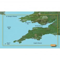
Garmin Bluechart G3 Vision VEU463S Bristol Channel and England S. West
VEU4463S Garmin BlueChart G3 Vision - Bristol Channel and England S. West
Premier Coastal Charts
Industry-leading coverage, clarity and detail with new charts that feature integrated Garmin and Navionics content
Auto Guidance1 quickly calculates a suggested route by using your desired depth and overhead clearance
Includes Depth Range Shading for up to 10 depth ranges, enabling you to view...
Garmin Bluechart G3 Vision VEU464S Penmarch To Les Sables
VEU464S Garmin BlueChart G3 Vision -Penmarch To Les Sables
Premier Coastal Charts
Industry-leading coverage, clarity and detail with new charts that feature integrated Garmin and Navionics content
Auto Guidance1 quickly calculates a suggested route by using your desired depth and overhead clearance
Includes Depth Range Shading for up to 10 depth ranges, enabling you to view your target...
Garmin Bluechart G3 Vision VEU465S La Baule To San Sebastian
VEU465S Garmin BlueChart G3 Vision - La Baule To San Sebastian
Premier Coastal Charts
Industry-leading coverage, clarity and detail with new charts that feature integrated Garmin and Navionics content
Auto Guidance1 quickly calculates a suggested route by using your desired depth and overhead clearance
Includes Depth Range Shading for up to 10 depth ranges, enabling you to view your target...
Garmin Bluechart G3 Vision VEU467S Blackpool To Cardiff
VEU467S Garmin BlueChart G3 Vision - Blackpool to Cardiff
Premier Coastal Charts
Industry-leading coverage, clarity and detail with new charts that feature integrated Garmin and Navionics content
Auto Guidance1 quickly calculates a suggested route by using your desired depth and overhead clearance
Includes Depth Range Shading for up to 10 depth ranges, enabling you to view your target...
Garmin Bluechart G3 Vision VEU482S Wexford To Dingle Bay
VEU482S Garmin BlueChart G3 Vision - Wexford to Dingle Bay
Premier Coastal Charts
Industry-leading coverage, clarity and detail with new charts that feature integrated Garmin and Navionics content
Auto Guidance1 quickly calculates a suggested route by using your desired depth and overhead clearance
Includes Depth Range Shading for up to 10 depth ranges, enabling you to view your target...
Garmin Bluechart G3 Vision VEU483S Galway Bay To Cork
VEU483S Garmin BlueChart G3 Vision - Galway Bay to Cork
Premier Coastal Charts
Industry-leading coverage, clarity and detail with new charts that feature integrated Garmin and Navionics content
Auto Guidance1 quickly calculates a suggested route by using your desired depth and overhead clearance
Includes Depth Range Shading for up to 10 depth ranges, enabling you to view your target depth...
Garmin Bluechart G3 Vision VEU484S Ireland Northwest
VEU484S Garmin BlueChart G3 Vision - Ireland Northwest
Premier Coastal Charts
Industry-leading coverage, clarity and detail with new charts that feature integrated Garmin and Navionics content
Auto Guidance1 quickly calculates a suggested route by using your desired depth and overhead clearance
Includes Depth Range Shading for up to 10 depth ranges, enabling you to view your target depth...
Garmin Bluechart G3 Vision VEU500S Blyth To Lowestoft
VEU500S Garmin BlueChart G3 Vision - Blyth To Lowestoft
Premier Coastal Charts
Industry-leading coverage, clarity and detail with new charts that feature integrated Garmin and Navionics content
Auto Guidance1 quickly calculates a suggested route by using your desired depth and overhead clearance
Includes Depth Range Shading for up to 10 depth ranges, enabling you to view your target depth...
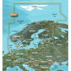
Garmin BlueChart G3 Vision VEU721L - Northern Europe
Experience unparalleled coverage and brilliant detail when you're on the water. BlueChart G3 Vision coastal charts provide industry-leading coverage, clarity and detail with integrated Garmin and Navionics content. Compatible with the Garmin GPSMAP and ECHOMAP series Chartplotters.
Garmin BlueChart G3 Vision VEU722L - Europe Atlantic Coast
Experience unparalleled coverage and brilliant detail when you're on the water. BlueChart G3 Vision coastal charts provide industry-leading coverage, clarity and detail with integrated Garmin and Navionics content. Compatible with the Garmin GPSMAP and ECHOMAP series Chartplotters.
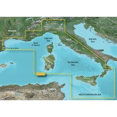
Garmin BlueChart G3 Vision VEU723L - Southern Europe
Experience unparalleled coverage and brilliant detail when you're on the water. BlueChart G3 Vision coastal charts provide industry-leading coverage, clarity and detail with integrated Garmin and Navionics content. Compatible with the Garmin GPSMAP and ECHOMAP series Chartplotters.
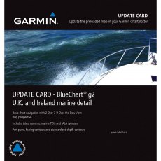
Garmin UK & Ireland G2 Bluechart Update MicroSD/SD Card
This preprogrammed update card for your chartplotter gives you detailed electronic nautical charts that provide a smooth data transition between zoom levels. Data includes navaids, port plans, depth contours, fishing contours, spot soundings and more. Sharp, colorful graphics let you see every cartographic contour and feature, with a minimum of panning and zooming to bring the chart data into focus.
Garmin BlueChart G3 - HXEU012R: Mediterranean, Central-West
BlueChart g3 coastal charts provide industry-leading coverage, clarity and detail with integrated Garmin and Navionics data. Also included is Auto Guidance technology, which uses your desired depth and overhead clearance to calculate routes and provide a suggested path to follow — overlaid onto your chart. NOAA raster cartography is also available as a free downloadable feature via the ActiveCaptain app. It gives your chartplotter paper chartlike views of NOAA-surveyed areas in which individual points of interest are labelled with corresponding longitude and latitude information. Worldwide coverage is available by regions as accessory cards or via download; each region is sold separately. Compatable with ECHOMAP™ Plus series chartplotters.
Garmin BlueChart G3 Vision - VEU463S: Bristol Chan & SW Eng
Experience unparalleled coverage and brilliant detail when you're on the water. BlueChart G3 Vision coastal charts provide industry-leading coverage, clarity and detail with integrated Garmin and Navionics content. Compatible with the Garmin GPSMAP and ECHOMAP series Chartplotters.
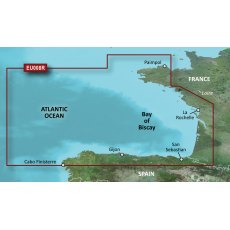
Garmin BlueChart G3 Vision Regular Area - VEU008R Bay of Biscay
Experience unparalleled coverage and brilliant detail when you're on the water. BlueChart G3 Vision coastal charts provide industry-leading coverage, clarity and detail with integrated Garmin and Navionics content. Compatable with the Garmin GPSMAP and ECHOMAP series Chartplotters.
Garmin Bluechart G3 Vision VEU001R English Channel
VEU001R Garmin Bluechart G3 Vision English Channel
Premier Coastal Charts
Industry-leading coverage, clarity and detail with new charts that feature integrated Garmin and Navionics content
Auto Guidance1 quickly calculates a suggested route by using your desired depth and overhead clearance
Includes Depth Range Shading for up to 10 depth ranges, enabling you to view your target depth at...
Garmin BlueChart G3 Vision VEU002R Dover to Amsterdam
VEU002R Garmin BlueChart G3 Vision Dover to Amsterdam
Premier Coastal Charts
Industry-leading coverage, clarity and detail with new charts that feature integrated Garmin and Navionics content
Auto Guidance1 quickly calculates a suggested route by using your desired depth and overhead clearance
Includes Depth Range Shading for up to 10 depth ranges, enabling you to view your target depth...
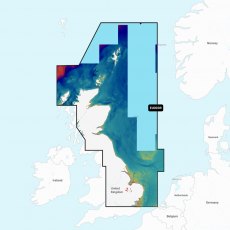
Garmin Bluechart G3 Vision VEU003R Great Britain- Northeast Coast
VEU003R Garmin Bluechart G3 Vision Great Britain- Northeast Coast
Premier Coastal Charts
Industry-leading coverage, clarity and detail with new charts that feature integrated Garmin and Navionics content
Auto Guidance1 quickly calculates a suggested route by using your desired depth and overhead clearance
Includes Depth Range Shading for up to 10 depth ranges, enabling you to view your...
Garmin Bluechart G3 Vision VEU004R Irish Sea
VEU004R Garmin Bluechart G3 Vision Irish Sea
Premier Coastal Charts
Industry-leading coverage, clarity and detail with new charts that feature integrated Garmin and Navionics content
Auto Guidance1 quickly calculates a suggested route by using your desired depth and overhead clearance
Includes Depth Range Shading for up to 10 depth ranges, enabling you to view your target depth at a glance
Up...
Garmin Bluechart G3 Vision VEU005R Ireland- West Coast
VEU005R Garmin Bluechart G3 Vision Ireland- West Coast
Premier Coastal Charts
Industry-leading coverage, clarity and detail with new charts that feature integrated Garmin and Navionics content
Auto Guidance1 quickly calculates a suggested route by using your desired depth and overhead clearance
Includes Depth Range Shading for up to 10 depth ranges, enabling you to view your target depth...
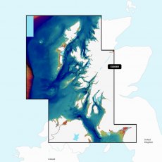
Garmin Bluechart G3 Vision VEU006R Scotland- West Coast
VEU006R Garmin Bluechart G3 Vision Scotland- West Coast
Premier Coastal Charts
Industry-leading coverage, clarity and detail with new charts that feature integrated Garmin and Navionics content
Auto Guidance1 quickly calculates a suggested route by using your desired depth and overhead clearance
Includes Depth Range Shading for up to 10 depth ranges, enabling you to view your target depth...
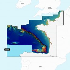
Garmin Bluechart G3 Vision VEU008R Bay Of Biscay
VEU008RGarmin Bluechart G3 Vision Bay Of Biscay
Premier Coastal Charts
Industry-leading coverage, clarity and detail with new charts that feature integrated Garmin and Navionics content
Auto Guidance1 quickly calculates a suggested route by using your desired depth and overhead clearance
Includes Depth Range Shading for up to 10 depth ranges, enabling you to view your target depth at a...
Garmin Bluechart G3 Vision VEU018R Benelux Offshore & Inland Waters
VEU018R Garmin Bluechart G3 Vision Benelux Offshore & Inland Waters
Premier Coastal Charts
Industry-leading coverage, clarity and detail with new charts that feature integrated Garmin and Navionics content
Auto Guidance1 quickly calculates a suggested route by using your desired depth and overhead clearance
Includes Depth Range Shading for up to 10 depth ranges, enabling you to view...
Garmin Blue Chart G3 Vision Large Area - VEU721L Northern Europe
Experience unparalleled coverage and brilliant detail when you're on the water. BlueChart G3 Vision coastal charts provide industry-leading coverage, clarity and detail with integrated Garmin and Navionics content. Compatible with the Garmin GPSMAP and ECHOMAP series Chartplotters.
Garmin Navionics Vision+ Chart: EU003R - Great Britain, NE Coast
Coastal coverage of the northeast coast of Great Britain from the mouth of the Thames to the Isle of Lewis including the Orkney Islands, the Shetland Islands and North Sea offshore charts. Coverage includes areas such as the Caledonian Canal, Loch Linnhe, Loch Ness, Edinburgh and London. Supplied on a SD-Card (Micro SD With SD-Card Adapter).
Garmin Navionics Vision+ Chart: EU006R - Scotland, West Coast
Coastal coverage of the western coast of Scotland from Cape Wrath to Solway Firth including the Isles of Lewis, Skye, Mull, Islay and many others. Also included is coverage of Northern Ireland from Londonderry to Belfast and Lough Neagh. Supplied on a SD-Card (Micro SD With SD-Card Adapter).
Garmin Navionics Vision+ Chart: EU008R - Bay of Biscay
Coastal coverage of the Atlantic coast of Europe from Dunkirk, France to A Coruna, Spain including the Channel Islands and the ports of Le Havre, Brest, Nantes, Saint-Nazaire and Bordeaux in France and Bilbao and Gijon in Spain. Supplied on a SD-Card (Micro SD With SD-Card Adapter).
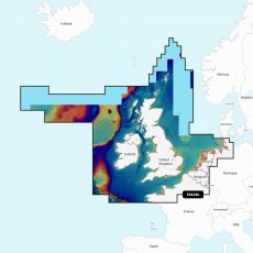
Garmin Navionics+ & Vision+ UK, Ireland & Holland EU628L
Detailed coverage of the UK, Ireland and the North Sea and English Channel coasts. Coverage includes the Shetland Islands, Orkney Islands, Isle of Man, Isle of Wight, the Isles of Scilly, the Channel Islands, the Thames River, the IJsselmeer, the Waddenzee and the Kiel Canal. Ports include London, Liverpool, Southampton, Edinburgh and Belfast, UK; Dublin and Cork, Ireland; Brest, Le Havre, Calais and Dunkirk, France; Antwerp, Belgium; Amsterdam and Rotterdam, The Netherlands; Bremerhaven, Hamburg and Kiel, Germany. Supplied on a SD-Card (Micro SD With SD-Card Adapter).
Garmin Navionics+ & Vision+ Europe, Central & West EU646L
Detailed coverage of central and western Europe. Coverage includes the European coast from the Szczecin Lagoon to Monaco; the Azores; Madeira; the Canary Islands; the Balearics; Corsica and Sardinia; Gibraltar, the English Channel; the Channel Islands; the IJsselmeer; the rivers of France, Germany and the Low Countries; Lakes Maggiore, Como, Garda, Geneva, Constance and Balaton. Supplied on a SD-Card (Micro SD With SD-Card Adapter).
Garmin Navionics+ & Vision+ Mediterranean & Black Sea EU643L
Detailed coverage of the Mediterranean and Black Seas. Coverage includes the Azores, Madeira, the Canary Islands, Gibraltar, the Balearic Islands, Corsica, Sardinia, Sicily, Malta, Crete, Cyprus, the Dardanelles, the Bosporos, the Sea of Azov, the Dneiper River to the Kyivs'ke Reservoir, the Danube River to Passau, Germany, Lake Balaton, Lake Garda, Lake Como and Lake Maggiore. Ports include Cadiz and Barcelona, Spain; Monaco; Marseille and Toulon, France; Genoa, Naples, Taranto and Venice, Italy; Istanbul, Turkey; Odessa, Ukraine; Tunis, Tunisia and Algiers, Algeria. Supplied on a SD-Card (Micro SD With SD-Card Adapter).


